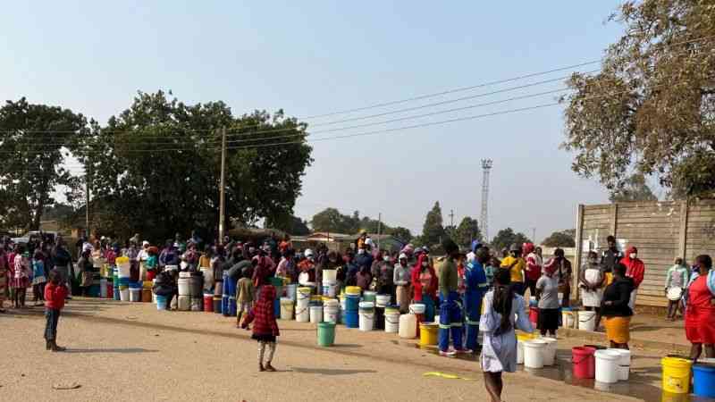
THE Bulawayo City Council (BCC) says it will soon institutionalise its Geographical Information Services (GIS) to ensure all infrastructure such as roads, water, sewer, consumer meters and property boundaries were under a 24-hour surveillance to improve service delivery.
By Ngoni Chanakira
“There are too many burst pipes and leaks causing water shortages in our city,” council’s GIS officer Sibusisiwe Sibanda said.
“We need to improve infrastructural arrangements in our city. This will improve earnings for council.”

BCC is the first, and probably, the only municipal authority that has introduced the GIS system as well as a 24-hour command centre to monitor services distributed throughout the city.
Sibanda, in an interview, said the availability of quality and relevant data and information was a necessary foundation for effective knowledge management.
“It is estimated that spatial data and information constitutes 80% or more of the data and information within a municipality.
- Chamisa under fire over US$120K donation
- Mavhunga puts DeMbare into Chibuku quarterfinals
- Pension funds bet on Cabora Bassa oilfields
- Councils defy govt fire tender directive
Keep Reading
“The use of spatial information is fundamental to the urban planning and management of the municipal area as most, if not all, urban management issues have a spatial dimension.”
The local authority started implementing GIS in June 2011.