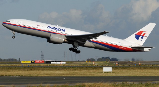
![A Malaysia Airlines Boeing 777-200 takes off [Image credit: Bruno Muthelet]](http://www.extremetech.com/wp-content/uploads/2014/03/malaysia-airlines-boeing-777-200-640x353.jpg)
There has possibly been a breakthrough in the search for flight MH370. Australian authorities say they’ve found what appears to be the debris of the plane in some satellite imagery (pictured below).
The debris is located about 1,500 miles (2,500km) from Perth in the Indian Ocean, off the south-west corner of Australia, along the same arc provided by the Inmarsat pings (see previous update below). Unfortunately, though, the Royal Australian Air Force (RAAF) sent an airplane to investigate the area — and could not locate any debris.
“RAAF P3 crew unable to locate debris. Cloud & rain limited visbility. Further aircraft to continue search for #MH370,” the Australian Maritime Safety Authority said in a tweet. Malaysian authorities haven’t said much on the matter, only that this is the only credible lead that we have, so of course it will be investigated fully.


Possible location of MH370 debris, off the coast of Perth [Image credit: Sydney Morning Herald]
Updated @ 14:42 March 18: 11 days in, and we still have no idea what fate befell Malaysia Airlines flight MH370, or the 239 souls on board. We now know that the plane’s Satcom link continued to ping an Inmarsat communications satellite (geosynchronously orbiting above the Indian ocean) for seven hours after last civilian air traffic control contact, until 8:11am local time.
- Chamisa under fire over US$120K donation
- Mavhunga puts DeMbare into Chibuku quarterfinals
- Pension funds bet on Cabora Bassa oilfields
- Councils defy govt fire tender directive
Keep Reading
If the plane did continue flying for seven hours, it would probably have ended up in China’s Taklamakan desert on the Kyrgyzstan border. This is a fairly appealing theory, as there would be plenty of space up there to land a plane without anyone noticing. The main problem with the “continued flight” theory though — even if the plane went south into the Indian Ocean instead — is that it would’ve had to cross the airspace of multiple countries without being spotted by military radar. If this really is the case — if the plane continued to fly on for seven hours — it’s really starting to sound like the disappearance of flight MH370 was an incredibly sophisticated hijack, or the actions of a government-level conspiracy.

A map showing the location of the Inmarsat that received Satcom pings from MH370, and the plane’s radius from the satellite (calculated from the “ping” round-trip time).
Updated @ 19:20 March 16: Somewhat unbelievably, more than a week after Malaysian Airlines flight MH370 disappeared, we still have absolutely no idea where the plane is. We are, however, starting to work out what happened. Basically, the Malaysian military have now admitted that they were tracking an unidentified contact across the country, and did nothing about it. It has now been confirmed that the unidentified contact was flight MH370.
It seems, shortly after it completed its climb out of Kuala Lumpur airport, that the plane’s ACARS tracking system was manually disabled by someone on the Boeing 777 — presumably one of the pilots. (Disabling the system would be impossible to do without both pilots knowing, however.)
Malaysian military radar tracked the plane to the Strait of Malacca at 2:15am local time, and then the plane vanished. It has also emerged that the plane continued to send data to an Inmarsat satellite for five hours after last contact. 25 countries are now searching for the plane, across a huge swath of Asia (pictured below). At this point, hijacking is by far the most likely cause of this utterly insane scenario.
![Flight MH370, possible routes, if it carried on flying for a further five hours. [Image credit: BBC]](http://www.extremetech.com/wp-content/uploads/2014/03/73602229_possible_plane_area3_6243.jpg)
Flight MH370, possible routes, if it carried on flying for a further five hours. [Image credit: BBC]
Updated @ 08:05 March 14: It’s now been almost a week since flight MH370 disappeared without trace. From official Malaysian sources, there is still no news to report. According to an exclusive report by Reuters, however, some investigators are now fairly certain that the Malaysian Airlines Boeing 777 did in fact fly on for another four hours.
Apparently, shortly after the last time it appeared on civilian radar (around 1:30am local time), MH370 turned west and started following navigational waypoints (Vampi, Gival, Igrex) usually used by flights towards the Middle East and Europe. According to two sources speaking to Reuters, the fact that the airplane simply vanished from air traffic control and civilian radar would suggest that someone on board the plane disabled its communication systems.
If this new information is correct, MH370 actually disappeared somewhere in the Indian Ocean, near the Andaman Islands. Reuters says Malaysian authorities are now asking for radar data from Thailand, Indonesia, and India — all of which may have picked up flight MH370 after it vanished.

Malaysian Airlines MH370′s flight path after it vanished, according to the Reuters report. [Image credit: Daily Mail]
Updated @ 09:40 March 13: The farcical hunt for Malaysian Airlines flight MH370 continues. US investigators believe the plane may have continued for four further hours after its last sighting — a claim that Malaysian authorities have strongly denied. Malaysian authorities say they have spoken to both Boeing and Rolls-Royce, and they both confirmed that the plane’s last ACARS transmission was at 1:07am, and at that time the plane was completely healthy.
The radar blips at 2:15am (near the Strait of Malacca) and again at 2:30am, after being confirmed and then denied, are being investigated yet again. China released satellite images of the purported wreck of MH370 (below), but Malaysia’s transport minister said they were released by mistake and ”did not show any debris from MH370.” Read on for previous updates and the original story.
Updated @ 14:10 March 12: As darkness falls over south-east Asia, the fifth day of the MH370 search-and-rescue mission draws to a close. There’s still absolutely no indication of what happened to flight MH370, nor where it landed. The Malaysian authorities continue to flail embarrassingly. Crazy theories continue to be proposed.
The search-and-rescue efforts now comprise of 42 ships and 39 aircraft from 12 different countries. DigitalGlobe is providing high-res satellite imagery of the search area, with analysis of the imagery then being crowdsourced by Tomnod — and apparently there’s now a third possible location where the plane might’ve disappeared. So far, though, all of these efforts have turned up absolutely nothing.

Satellite photos released by China, which it claims shows the wreck of flight MH370

Updated @ 08:25 March 12: This morning, as the search for flight MH370 heads into its fifth day, Malaysian authorities held a press conference in Kuala Lumpur to discuss the latest developments. Sadly, there wasn’t really much to report. The Malaysian military are now denying that MH370 was tracked to the Strait of Malacca.
The search area now covers 27,000 square nautical miles, 12,000+ in the Strait of Malacca and 14,000+ in the South China Sea (the plane’s last known location). Rolls-Royce, which made the Boeing 777′s Trent 800 engines says it received two batches of engine diagnostic data from the plane after takeoff and during the cruise, as part of the Aircraft Communications Addressing and Reporting System (ACARS) – but there’s nothing unusual about that. It does imply, however, that Malaysian Airlines — which received the full ACARS report — would know by now if the plane was suffering from any issues. As the airline hasn’t said anything about the ACARS report, it’s probably fairly safe to assume that all systems were functioning normally.
Updated @ 16:35 March 11: The fourth day of the MH370 search-and-rescue mission has come to a close, and we’re still no closer to finding the missing plane. The search area has been expanded from 50 nautical miles (57 miles; 93km) to 100 nautical miles. It has also come to light that MH370′s co-pilot, Fariq Abdul Hamid, was extremely unprofessional during a flight in 2011.
On a flight from Phuket to Kuala Lumpur, Hamid invited two South African teenagers into the cockpit, where they remained for the entirety of the flight, while he and the pilot smoked cigarettes while flying the plane. Whether this new finding has any bearing on the fate of MH370, we’ll have to wait and see.
Updated @ 08:40 March 11: As the Malaysia Airlines MH370 search-and-rescue mission enters its fourth day, we still know almost nothing about the fate of the plane and the 239 people on board. Two passengers were travelling with stolen passports, but Interpol says they weren’t terrorist threats.
According to Malaysian military radar, it now seems likely that MH370 turned back after its last contact with air traffic control, possibly crashing into the Strait of Malacca. We still have no idea why it turned back, or where the plane ended up.
Updated @ 19:30 March 10: Very little new information has come to light since this story was first published this morning. Despite some oil slicks and debris being found in the South China Sea, authorities have confirmed that they didn’t originate from the MH370. Numerous experts have attested to the Boeing 777′s excellent reliability and safety record, and puzzlement at how it could vanish from the skies.
We still have no idea how or why the plane disappeared, nor where it crashed. There are very, very few reasons for a modern plane to suddenly disappear. Read on for the original story.
Three days ago, Malaysia Airlines flight MH370 vanished from radar off the south coast of Vietnam in the South China Sea. 239 people were on board — and at this point, it is presumed that they have all perished in some kind of disaster.
A massive search and rescue effort involving 40 ships and 34 aircraft from nine different nations has yet to discover any sign of the missing aircraft. For me, this is almost incomprehensible: Despite all of the awesome technology that mankind has developed, it’s still possible for a Boeing 777-200 with 239 people on board to vanish.
For me, it’s mind blowing that all we have to go on is the plane’s radar signature — and even then, that last radar reading was so poor that the search area is thousands of square miles of open water. Surely, given the fact that we can track a damn smartphone anywhere on Earth down to a few meters, there’s a better way of keeping track of missing aircraft?
In the words of Malaysia’s civil aviation chief, the fate of MH370 is “a mystery.” The Boeing 777 took off from Kuala Lumpur in Malaysia en route to Beijing, was cruising normally at 35,000 feet… and then disappeared. There was no distress call.
The weather was fine. The plane’s last known position, via radar, was just south of Vietnam in the South China Sea — which is where search efforts have been focused so far — but one theory suggests that the plane turned back just after the last radar ping, meaning the plane could be hundreds of miles away in the Strait of Malacca. In the absence of any other information, there is speculation that the plane was target of a terrorist attack.

Flight MH370′s known route, and suspected route to the last confirmed radar reading [Image credit: BBC]
For me, the most shocking aspect of the MH370 disaster is that we won’t know what fate befell those 239 souls until we find MH370′s Flight Data Recorder (FDR), aka the black box. Except for that last radar reading, we have absolutely no knowledge of the flight at all until we find that FDR. We have no clue what was said in the cockpit by the captain and first officer — though, seemingly, if something did go wrong, they didn’t even have time to send a mayday message. We have no clue if the plane hit a patch of bad weather, or whether it was hijacked. It really will be one huge mystery until the FDR is recovered — and there’s a good chance, if MH370 did crash into the ocean, that the FDR will never be recovered. In the case of Air France flight AF447, which disappeared off the coast of Brazil, it took two months to locate the wreckage, and almost two years to find the the Cockpit Voice Recorder (CVR) and FDR.
The FDR has an underwater locator beacon (ULB) that will ping for at least 30 days, and can be detected up to around two miles away, but when you’re talking about a search area consisting of thousands of square miles, and waters that are almost a mile deep on average, finding the black box will be no mean feat. (Read: Worried about black boxes snooping on you? One is in your car already.)
Do we live in the stone age or something?
Inside a modern, solid-state Cockpit Voice Recorder. The Flight Data Recorder is very similar.
So, think about this for a moment. We live in a day and age where GPS (and other radio triangulation methods) can track your smartphone to within a few meters, almost anywhere on Earth. With dedicated, land-based tracking networks, vehicles and devices can be tracked to within a few centimeters. Even in the absence of GPS or radio tracking, inertial guidance (dead reckoning) has been accurate enough since the ’60s to accurately land a nuclear ICBM on the other side of the planet, or put the Apollo mission into space. (Read: Think GPS is cool? IPS will blow your mind.)
And then there’s connectivity. On land, there are networks (both commercial and governmental) that provide data connectivity almost everywhere. Over water is definitely harder, but satellites do provide pretty good coverage — and yes, that particular region of Asia is very well covered by communications satellites. Finally, even if an aircraft is out of satellite/radio coverage, there is absolutely nothing preventing the airplane from transmitting a really juicy low-frequency radio signal that could be picked up thousands of miles away. This is how they communicate with air traffic control, after all.
Why, then, does a plane like the MH370 keep all of its secrets locked up in a black box? Why don’t planes constantly transmit all of their black box data, so that we know their exact location, bearing, altitude, and other important factors, at all times?
The short answer is, there’s no good reason.
-EXTREME TECH